..
Garmin Tracklogs - Which is Best
for You?
(15 Sept. 2000)
 ..
.. ..
..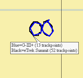
eTrex Summit 2.05
G-III+ in 0.01km Dist. Mode Combined
Display of 50-foot Diameter Circles
The eTrex Summit places a trackpoint about every 12 feet while walking
(6.8-mile capacity for 3,000 trackpoints), and has a 'driving' capacity
of about 150 miles. The automatic tracklog mode of the eTrex Summit
isn't adjustable. The G-III+ 0.01km Dist. Mode places a trackpoint
about every 30 feet, and has a 'driving' capacity of about 12 miles.
(This can be extended indefinitely with other tracklog modes and settings).
The eMap doesn't record as many trackpoints as the Summit, and its walking
tracklog is 'barely adequate'.
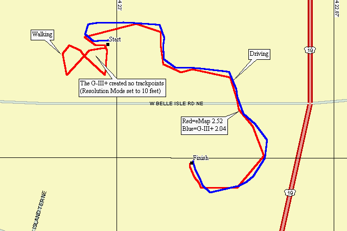
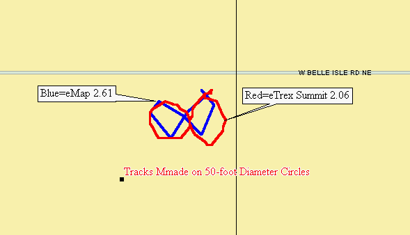
In this plot, the G-III+ has been set to a Resolution Mode of 10
feet, and the eMap is default. The G-III+ didn't lay down ANY trackpoint
while walking! And the eMap drew a figure-8 plot with only eight
trackpoints. The G-III+ apparently has the old threshold limit for
setting trackpoints of 1m/sec (2.3mph) that the eMap once had.
While driving about 5 mph, the G-III+ laid down more trackpoints
than the eMap, indicating that the resolution of the eMap is set to something
greater than 10 feet.
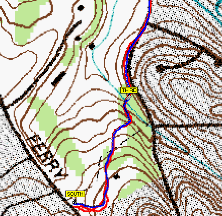
Here the actual trail is blue and red is an out-and-back Summit
tracklog. The topo map is a DRG zoomed in 2x.
So those wishing to record trail tracks
while walking can now use the eTrex Summit, G-III+ (in the Dist. Mode),
or the eMap (if the best trail resolution isn't required). Prior
to Ver. 2.52, the eMap was not able to record a useful tracklog while walking.
Jack
Yeazel