Return to home page * Text by jack yeazel
(4 July 2007)
Topo Maps in the Atlanta Area

Garmin USA Topo (from
the USGS 1:100,000 topo maps)

Garmin's TOPO U.S. 2008
(From DEM data with Shading)
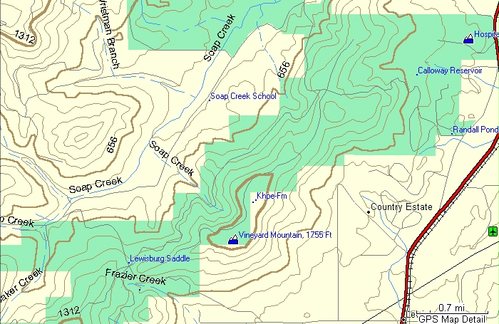
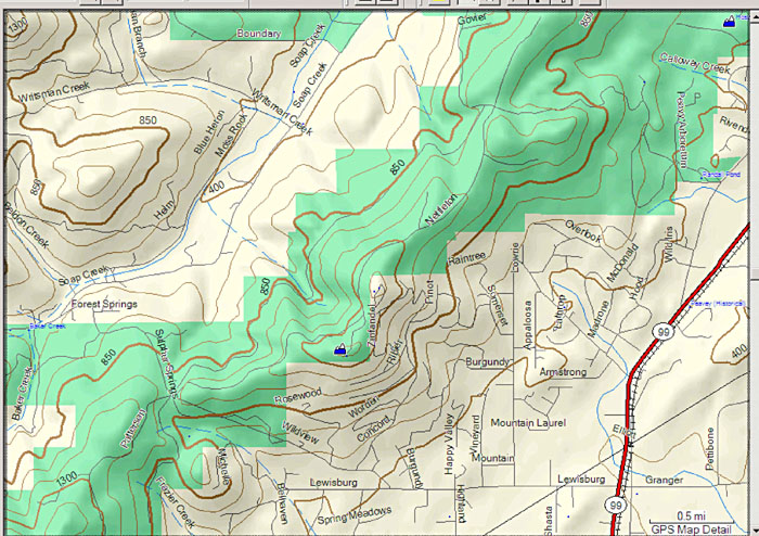
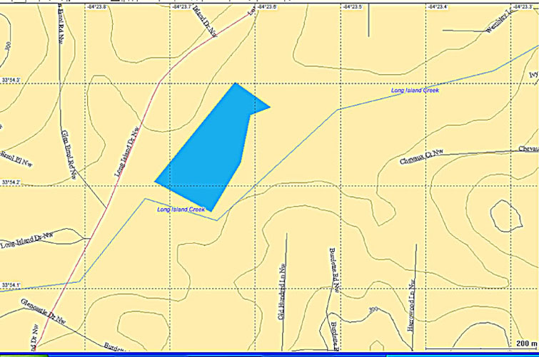
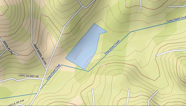
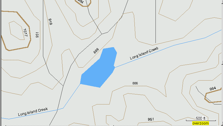
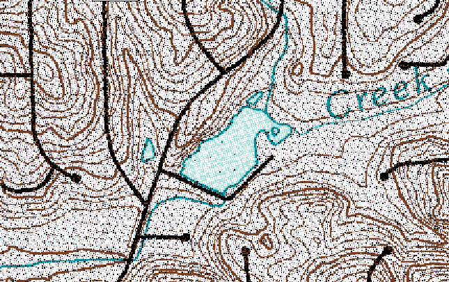
Topo Maps in the Atlanta Area
Garmin USA Topo (from
the USGS 1:100,000 topo maps)
Garmin's TOPO U.S. 2008
(From DEM data with Shading)
General:
The new TOPO 2008 maps are approximately $90 -check
for latest discount prices (HERE).
These maps are constructed from DEM (Digital Elevation Model) data instead
of a digitized version of the USGS 1:100,000 topo maps for the older USA
Topo maps. Contour lines from DEM data are interpolated between the
elevation points, which can be 10m, 30m, 90m, or more, rectangular cells.
A very small part of the US is surveyed at 10m cells. It appears
that the new Garmin topo maps are using the 30m cells. Using DEM
data also lends itself to calculating shading. To turn the
shading ON or OFF in MapSource, go to: Edit, Preferences, Display.
(The shading isn't transferred to the unit).
The TOPO 2008 street data have fewer vectors than USA Topo, but the streets are named. The street data appear to be from a late TIGER database. Since the contour interval (in the Atlanta area) has been reduced from 32 feet to 25 feet, there are more contour lines. However, in the mountainous area of Oregon, the USA Topo maps actually have more contour lines than the Topo 2008 maps (see below)
There has been some discussion that the elevations of certain peaks have different values than other maps. So far, we've not been able to determine which maps are more authoritative. There also was hope that the segments would be larger, so the 2025 segment limit with many units would not be an issue for those wanting to load the complete map onto the new microSD cards which can hold up to 4GB. (The 2008 topo maps have a total of 6633 segments.)
Usage:
The new topo map shading can be used to quickly evaluate
a terrain of interest on a PC. Also the more densely-spaced contour
lines will be helpful for orienting one's self in a strange area.
The addition of street names will be helpful, but don't expect to see Garmin's
usually accurate street placements as with the USA Topo maps. The
map doesn't autoroute, however selecting a GoTo will cause most units to
autoroute on the base map.
Topo Maps in the Oregon Mountains
Garmin USA Topo with
131-foot Contours
Garmin's TOPO U.S. 2008
with 150-foot Contours
A Comparison of Lowrance,
Magellan, TOPO 2008, (DEM maps)
To USA Topo, and Satellite
Photo Map Contours
Lowrance USA Hunting Topo-6 (50-foot
contours)
Magellan MapSend Topo USA-3 using 90m
x 90m Cells (contours lack detail)
Magellan MapSend Topo 3-D Map
Using 30m x 30m Cells (30-foot Contours)
DeLorme Topo USA 6 "High" Display (10-foot
Contours)

Garmin USA TOPO U.S. 2008 from DEM
data (25-foot contours)
Garmin USA Topo Map from the USGS 1:100,000
topo maps (32-foot contours)
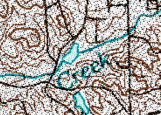
USGS 1:100,000 Topo Map from which
the Garmin USA Topo maps are Derived (10m contours)
USGS 1:24,000 Topo DRG Map (10-foot
contours)
USAPhotoMaps
B&W Aerial Photo uses 30m x 30m cells from the same database
As the Magellan MapSend Topo 3-D Map.
USAPhotoMaps
Color Aerial Photo uses 30m x 30m cells from the same database
As the Magellan MapSend Topo 3-D Map.