Return to GPS General Information Home Page
(15 Jan. 2002) Jack Yeazel
General:
See world wide coverage of these maps (HERE).
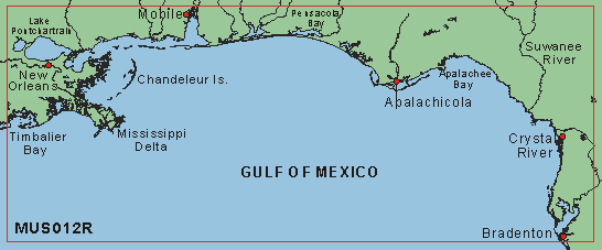
We purchased the MUS012R section of the Zone-1 Americas CD, because it
covered the west coast of Florida where we had previously recorded some
GPS tracks and waypoints. However, the tracks were made during a
fishing trip out the Homosassa River in 1996 with a Garmin G-45 -when Selective
Availability was alive and well! Therefore, the track sometimes "runs
aground" but is surprisingly accurate for its day. The five-mile
long Homosassa River, which is very narrow, is an ideal place to test the
ability of a GPS and a map to work together. The river is between
Bradenton and Crystal River (above).
Unlock:
The unlock code for MUS012R ($115.00, check latest prices HERE),
puts 139 MB of a 160 MB CD on your hard drive, which then no longer requires
the CD. There is an option to place only the chart in question on
the HD which, in our case, resulted in only 25 MB. Unlock codes for
additional sections are $85 each. There are 27 regions on the CD; this
would come to $2,210 to unlock the rest of the CD! There is no 'special'
to unlock the whole CD. The unlock codes are receiver-type and serial-number
aware. Garmin allows you to load BlueChart sections on two GPS units.
Garmin's directions to unlock a section were simple and easy to follow.
Maps:
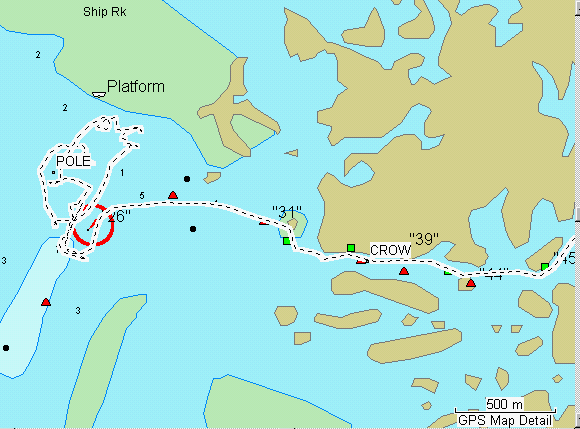
On the maps there are red triangles and black or green square navigation
markers. In nautical terms, "red-right-returning," that is, when
'returning' to port or going upstream, one keeps the red markers to the
right and black/green squares to the left. If you see a ship
(or airplane) and its red light is to the right of the green, it's 'returning
your way'. The navigation marker numbers are in quotation marks.
To read more about a buoy or marker, place the GPS or computer cursor on
the marker. On a computer, to zoom OUT and re-center, right-click;
to zoom IN and re-center, left-click. However, If you go to Tools
> (check) Selection, then a right-click on a marker will reveal all the
information available.
Comparisons:
Strangely enough, there is almost as much information in the MetroGuide
USA map as the BlueChart (BC). Seems like the BC is not a lot better,
but maybe "even a little bit better" is essential, if you are really using
it for navigation. Some of the BC data doesn't agree with the USGS
BSB chart of the same area. For example, the lighted marker on the
BSB chart is identified as "28" where BC has it as "26", and "81" on the
BSB is "79" on the BC. Not all the BSB markers are identified on
the BC.
Compatibility with Garmin Units:
From Garmin Cartography: "BlueChart CD data will upload to the Legend,
Vista, and G-V, and they will draw and display the BlueChart CD detail
properly. However, the "Find" function will not be supported. In
other words, with
MapSource BlueChart data loaded to the nearest navaids etc.
cannot be automatically searched for in the unit, as is possible in some
other units. The draw will be fine, though, and most extended text screens
will be available. Also, these three units do not support tide tables.
Such info can be accessed on the computer though. Also, if you click on
a BlueChart navaid with these units, the complete light info may not show
(period, etc.) as it can on MapSource and in the true BlueChart "marine"
units. The detail will draw great, though."
However, all units without an internal ID can't load BlueCharts, and the eMap, although containing an ID, doesn't have the processing power (according to Garmin) to display BlueCharts. The only units that can display tide tables are the GPSmap 76 and 76S. The tide tables are apparently stored permanently in the base map. See a description of using tide tables (HERE).
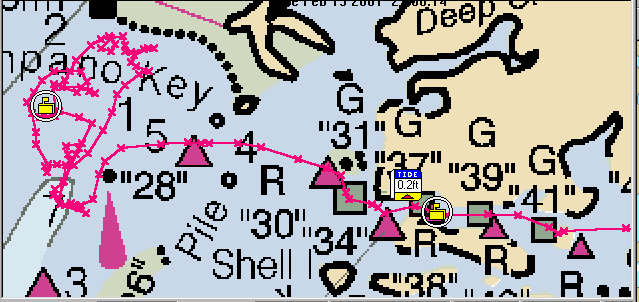
GPSmap 76
 .........
BlueChart
-
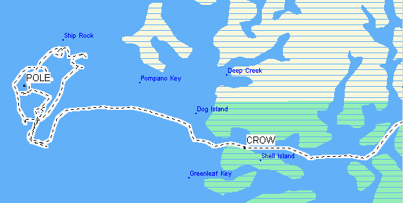
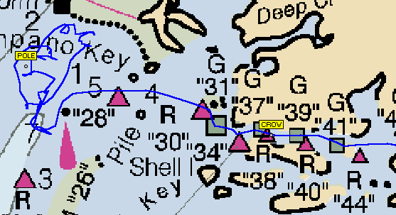
MetroGuide USA
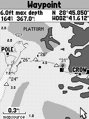
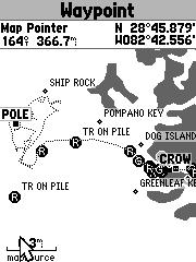
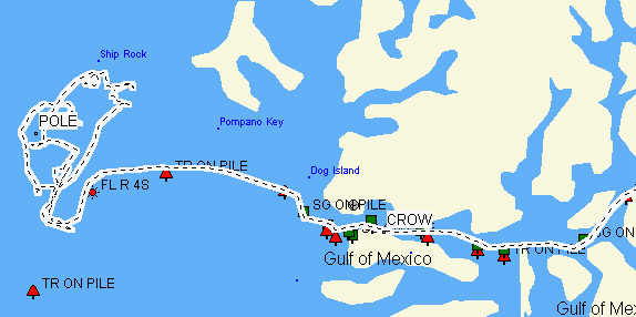
West coast of Florida at the mouth of the Homosassa River
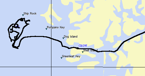
POLE and CROW (Crows Nest restaurant) are waypoints.
MapSource Display of BlueChart - Red markers are to be kept to right
when returning/upstream
MetroGuide USA
USA Topo
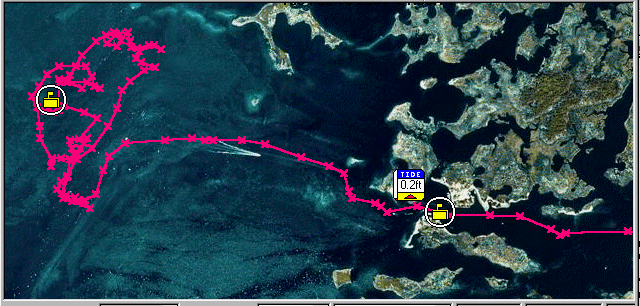
MapTech Offshore Navigator aerial-photograph display appears to be
highly accurate - Note the boat wake
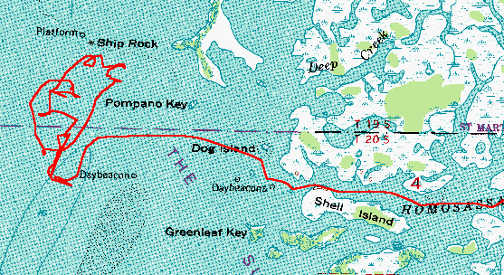
USGS DRG 1:24,000 Topo Map by Ozi Explorer
MapTech Offshore Navigator NOAA NOS chart display - Note that the waypoints
don't have names, only icons
NOAA NOS chart display by Ozi Explorer - Note that the waypoints have
names
Street Atlas 9 also has marine information
View more BlueChart comparisons (HERE)